360° аэропанорамы и виртуальные туры
For many businesses investment into panoramic aerial photography opens a whole new communication perspective. We call it immersive aerial imaging, format that makes people feel somewhat like birds. This is a great way of bringing yet another dimension to presentation of a location to your customers, adding new context to what you want them to see.
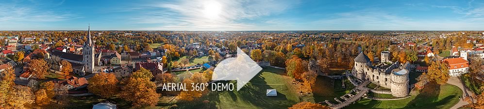
360º panoramas and photographs are taken with remote-control helicopters — they’re small, flexible and steady, so we can undertake very different technical challenges on a project.
When panorama is ready it can be used for aerial mapping. This means that we can mark any spot, area, point of interest on panorama, turning it into an interactive navigational tool to guide your visitor around a site.
«Here we plan to build a new residential building with a view over the sea», «this is where our tourist info centre is located» or «take this path to reach the medieval Teutonic castle» — one panorama can explain things better than a hundred words.
We can also merge panoramas into a virtual tour, so they are connected between each other through hotspots into a walking or «flying» sequence. Virtual tour comes with many possibilities, you can read more about this format here.
Aerial imaging works perfectly to promote property developments, tourist destinations — landmarks, routes, cities or regions; resorts, recreational and sports facilities. It can turn equally helpful for strategic urban planning, civil engineering, agriculture and nature protection projects.
We offer
— high-definition aerial 360º panoramic images
— interactive virtual tours based on aerial and ground panoramas
— enhanced tours with bird’s-eye view photography and video
— aerial mapping services